Why Elevation Certificates Matter in Flood-Prone Florida
April 28, 2026

Why Elevation CertificatesMatter in Flood Prone Florida
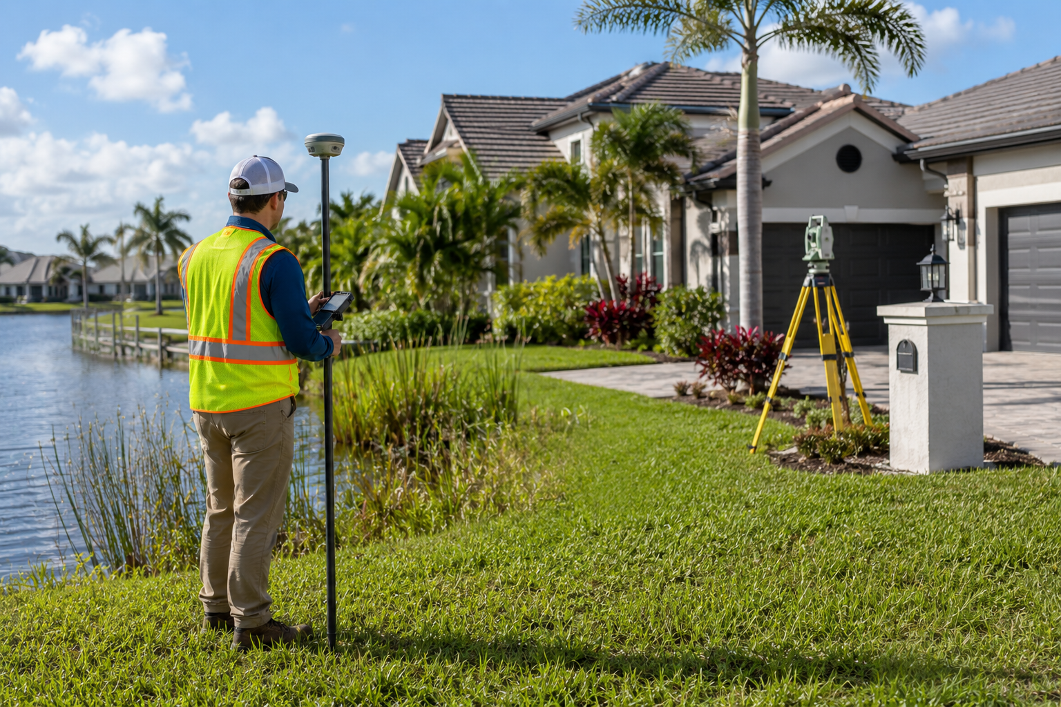
Flooding is a common concern across many parts of Florida, and elevationcertificates play an important role in understanding flood risk and insuranceneeds. An elevation certificate is an official document prepared by a licensedsurveyor that shows how a structure’s lowest floor compares to the base floodelevation established by FEMA. This information helps determine flood zonestatus and how flood risk is assessed.
Elevation certificates are commonly used for
• Purchasing or updating flood insurance
• Confirming whether a property lies within a special flood hazard area
• Verifying elevation data used by insurance providers
The information included in an elevation certificate allows insuranceprofessionals to accurately evaluate flood exposure rather than relying onassumptions.
Having an accurate elevation certificate can
• Reduce flood insurance premiums when a structureis above the flood elevation
• Prevent unnecessary coverage when flood risk is lower than expected
• Support map amendment requests when appropriate
• Provide clear documentation of a property’s elevation characteristics
Without an elevation certificate, flood insurance decisions are often basedon worst case assumptions, which can result in higher costs or coverage thatdoes not reflect actual conditions.
Many property owners believe elevation certificates are only needed forwaterfront homes, but flood zones can exist far from visible water sources.Drainage patterns, soil conditions, and surrounding development all influenceflood risk. Others assume that any survey includes elevation data, but only acertified elevation certificate includes the specific FEMA requiredmeasurements used for flood insurance purposes.
A professional elevation certificate includes
• Verified measurements of the lowest floorelevation
• FEMA required elevation data completed by a licensed surveyor
• Documentation of foundation type and flood related features
• A finished certificate accepted by flood insurance providers
At First Choice Surveying, we provide accurate elevation certificatesthroughout Florida, helping property owners better understand their flood riskand insurance options. If your property is in or near a flood zone, having theright information in advance can save time and expense. Contact First ChoiceSurveying to schedule your elevation certificate and gain clear, reliableelevation data for your property.
Related Articles
Lorem ipsum dolor sit amet, consectetur adipiscing elit.


Understanding Florida's Setback Florida’s Setback Requirements

What Makes Surveying a Beachfront Property Different
How Hurricanes and Water Tables Impact Surveys

Your First Choice for Land Surveys